
Breeze for Geological Analysis

Mineral Identification and Geological Mapping

Simplify geological analysis with Breeze software and the Geological Analysis module. Identify minerals, explore spectral features, and create mineral maps using powerful hyperspectral analysis tools — from data exploration to geological interpretation.

Reveal mineral patterns in hyperspectral data

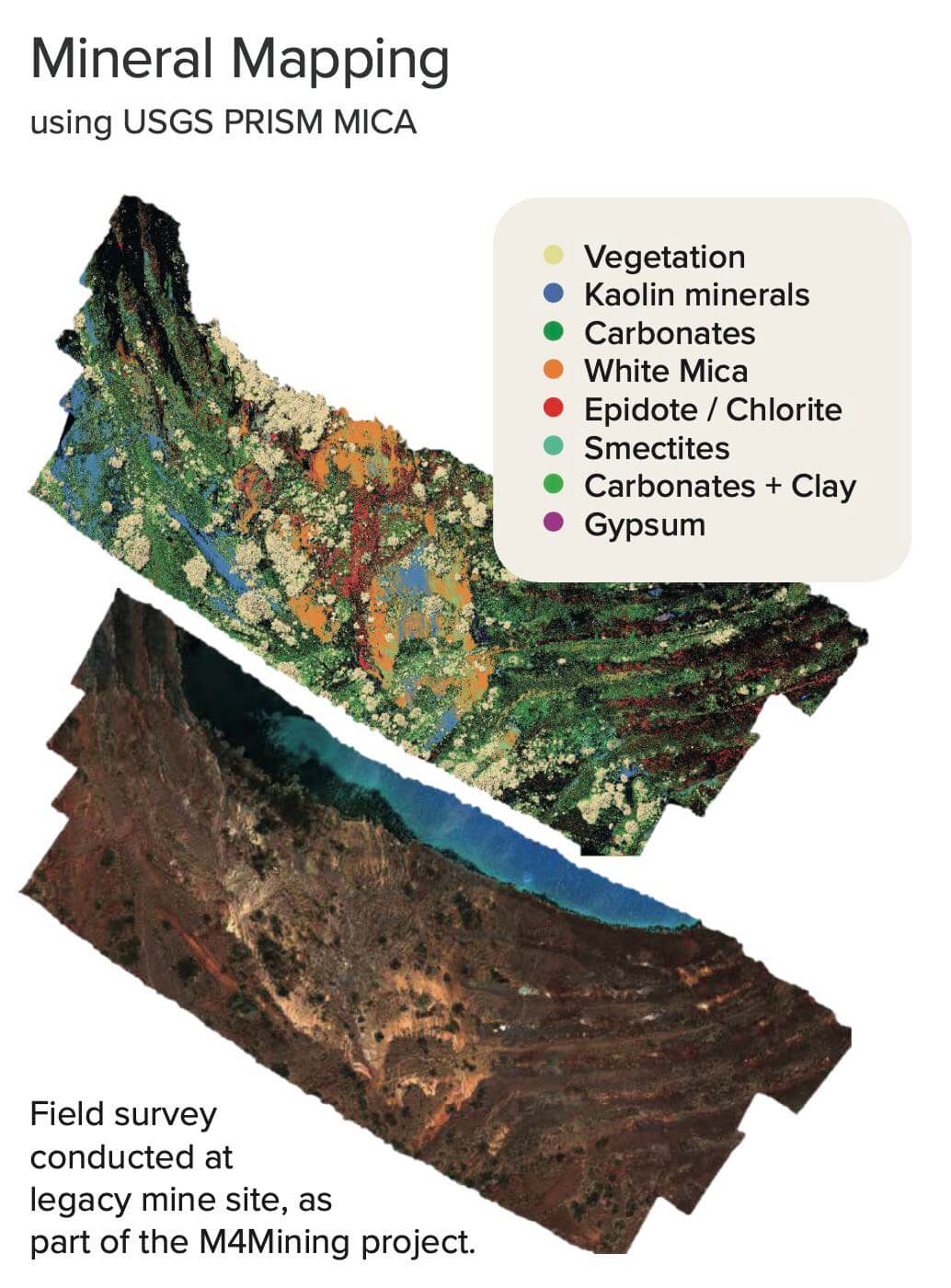
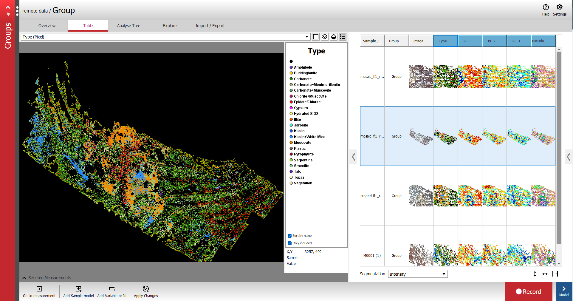
Explore mineral signatures with built-in and custom spectral libraries. Use USGS PRISM MICA for mineral classification and Minimum Wavelength Mapping to investigate spectral features, then export results for further geological interpretation.

Who it’s for

A geologist examining rocks outdoors.

Exploration geologists

Identify and map mineral signatures in field and remotely acquired images to support geological interpretation.

Laboratory teams

Compare mineral spectra and investigate variation across geological samples with built-in or custom spectral libraries.
Geoscience researchers

Evaluate classification methods, investigate spectral features and develop custom reference libraries for your research.

Why choose this package?

Turn hyperspectral images into mineral classifications and maps for geological interpretation.

  • Identify minerals: Classify spectral signatures using USGS PRISM MICA and spectral libraries.
  • Investigate spectral features: Use Minimum Wavelength Mapping to explore variation in your data.
  • Choose your references: Use built-in spectral libraries or develop custom libraries for your analysis.
  • Continue your interpretation: Review mineral maps and export results for further geological work.

From spectral data to mineral maps

Acquire or import images, analyse mineral signatures, and export maps for your geological workflow.

  • Bring image exploration and geological interpretation into one workflow.
  • Use built-in or custom spectral libraries to investigate mineral signatures.
  • Export mineral maps and analysis results for further interpretation.

Acquire or import

Record images using supported cameras and scanners, or import hyperspectral data from your geological application.

Classify and map

Identify minerals with USGS PRISM MICA and spectral libraries. Use Minimum Wavelength Mapping to investigate spectral features.

Review and export

Review mineral maps and spectral results, refine your interpretation, and export to industry-standard formats.

What’s included

Breeze provides the acquisition and analysis platform. Geological Analysis module adds mineral classification, spectral libraries and geological modelling tools.

Main software

Breeze

Acquire and analyze hyperspectral images, develop models and automate workflows. The main software required for all Breeze modules.
Module

Geological analysis module

Add mineral classification with USGS PRISM MICA, Minimum Wavelength Mapping and built-in or custom spectral libraries. Requires Breeze.

See geological analysis in action

See how Breeze supports mineral analysis and drill core workflows.

Explore geological applications

Core logging
Mineral mapping in open pit mines

Geological analysis key capabilities

Explore the mineral identification and mapping tools included with the Geological Analysis module.

USGS PRISM MICA

Material Identification and Classification Algorithm (MICA) Expert System is based on a spectral mineral library and provides USGS PRISM MICA expert system for material classification.

View documentation
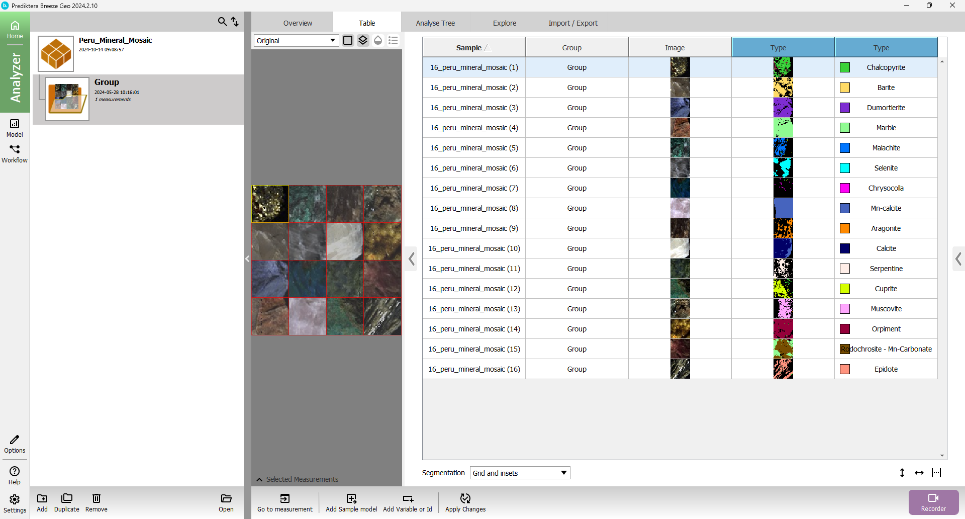
SAM – Spectral Angle Mapper

Identify minerals by matching hyperspectral signatures against reference spectra using Spectral Angle Mapper (SAM). Visualize mineral classifications and customize spectral endmembers to suit your geological samples.

View documentation
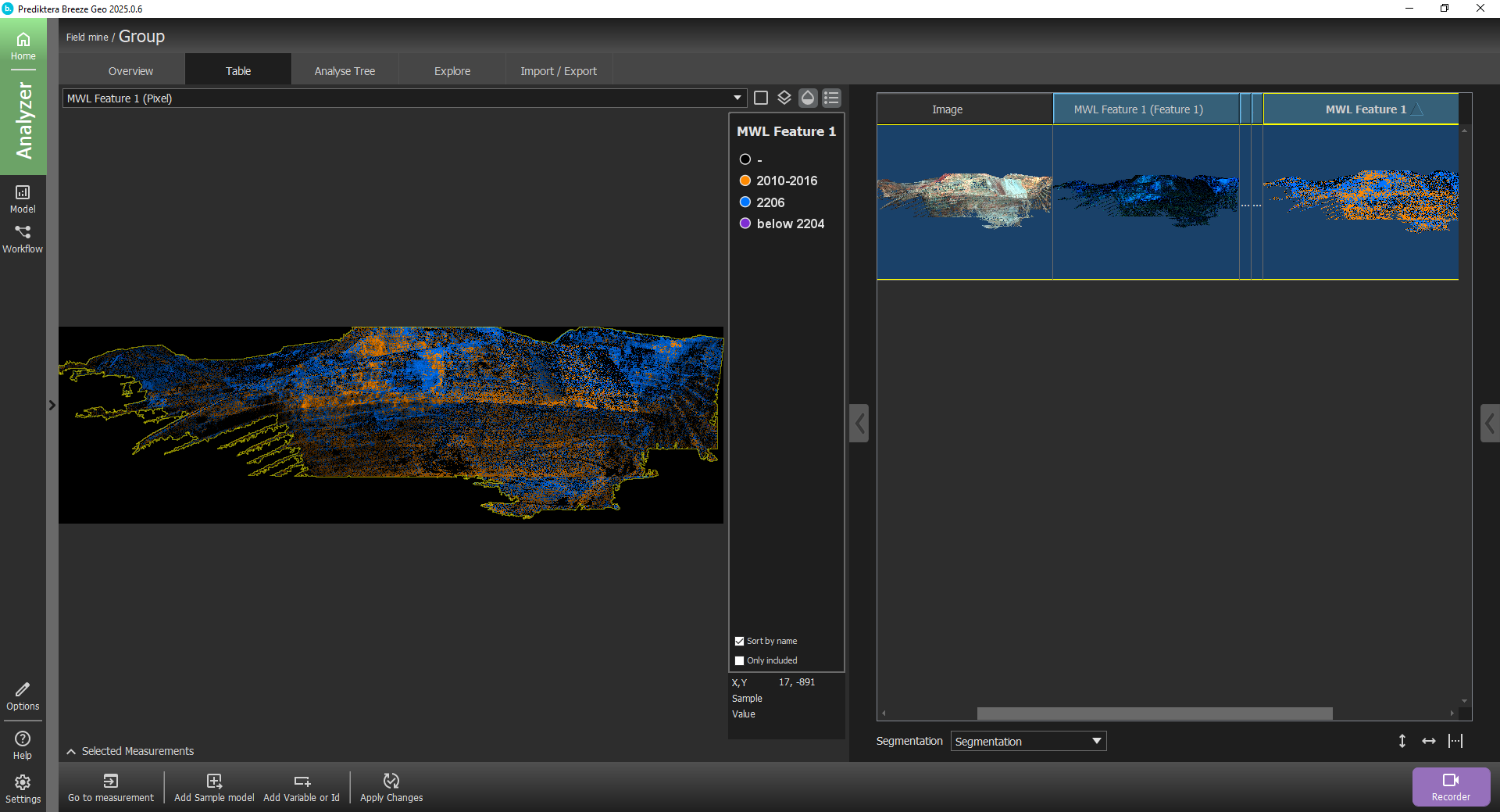
MWL

Minimum wavelength mapping (MWL) is a tool to find the absorption features within a specified wavelength region.

View documentation

Plan your geological analysis setup

Licensing options
Choose yearly or perpetual licensing. Yearly licences include support and updates for 12 months. Perpetual licences include the first 12 months, with optional support and update extensions.

Your data and equipment
Check camera compatibility, spectral range and system requirements against the minerals and samples you plan to analyse.

Core scanning and integration
Depth registration and core logging require the Core scanning package. Geological Runtime API integration is available separately. Training and application development support can also be purchased separately.

Discuss your mineral analysis application

Discuss your samples, minerals of interest and data sources. See the software in action and get guidance on the package and licensing for your setup.